Tabiat nur ato etmish,
Bu yerni Nurota derlar.
Kimiki ko‘rmagan bo‘lsa,
Kilibdur ul xato derlar.
Toshpulat Hamid
Nurota district is one of the large regions located in the north-east of the city of Navoi, almost in the heart of the Republic of Uzbekistan. It is surrounded by the regions of Jizzakh from the north-east, and Samarkand from the south-east and south. It borders with other districts of Navoi region from the west and south-west. Nurota district is located between 40 and 41 north latitudes, 65 and 66 east longitudes. In the same latitudes, there are large countries of the world such as USA, Portugal, Spain, Italy, Albania, Greece, China, Korea and Japan. Most of them are coastal countries with a humid and hot climate. Nurota is a dry, continental climate in the interior of the continent. In winter it is cold up to -39, and in summer it is hot up to +46. Average annual rainfall is 200-250 millimeters.
The area of the district is one of the largest districts of Uzbekistan. It is about 68 km from north to south and 95 km from west to east. The land area is 5936 square kilometers, and the total length of its borders exceeds 500 kilometers. Most of these borders pass through mountains, watershed ridges, most of them pass through Kyzylkum sand dunes, shorokhs, and Haydarkol waters. Its western part is the plain, the northern part is Haydarkol, the eastern part is the Nurota Mountains and the Nurota Plain, the south is the Oktov Mountains and its branch passes through Karatov.
The Nurota mountain range is the northwestern branch of the Pamir-Aloy mountain range and surrounds the Nurota valley from the north. And in the south lies Karatov (Kuhi syoh), Oktov (Kuhi safed) and Bakhiltov, which are rich in majestic, beautiful, serene gorges and have beautiful scenery. The highest peak of the Nurota mountain range is 2169 meters, and the highest peak of Oktov is Takhtkuh, which is 2005 meters high. Oktov is the most beautiful among the surrounding mountains. The snow does not melt quickly. Even when it's hot and the snow is falling, it's like a snow queen, dressed in white and blue. The Nurota Mountains adjoin the Xylkum plain from the west.
Geographical convenience of Nurota district has been noted for a long time. Archaeologist A. Kabirov believes that a branch of the "Silk Road" connecting China and Europe went to the Volga through Nur, Mingbulok basin, Khorezm. In fact, in the past there were two roads running from west to east on the territory of Uzbekistan. One passed through the Zarafshan Valley, and the other passed through the Nur Valley. If we turn to history, Alexander the Great went to Sir Valley through Nur, Bukhara in 329 BC. Later, the Seleucids from the north moved to the oasis of Kashkar through Nur in 207 BC. In 1033, the Seljuks crossed this road to Bukhara. In 1220, Genghis Khan's troops conquered Nur Castle and marched to Bukhara. In 1365, Amir Temur first took Nur and then moved to Bukhara.
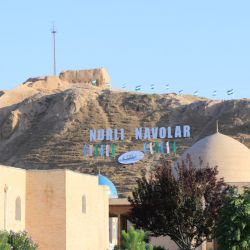
Nurota city is located almost in the center of Nurota district. It is located at an altitude of 500-512 meters above sea level. Nurota is an ancient fortress-city on the Great Silk Road network. In the preliminary research conducted by famous scientists Ya.Gulomov, P.Sh.Zokhidov, and O.M.Rostovsev, it is shown that primitive people - our ancestors - lived around the Light Spring even in the Upper Paleolithic period. According to the scientists of the Institute of Archeology of FA, the cultural layer around Nur Chashma is 35-40 thousand years old.
Muslims who believe in Islam acknowledge the presence of a holy spring and the graves and steps of saints in the city, glorifying the city as "Nurota - the Light of God", "Little Mecca". This led to further expansion of Nurota's connection with the outside world, becoming known and popular.
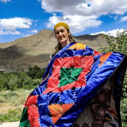
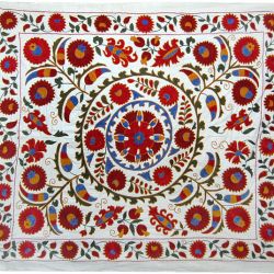
In the past, the people of Nurota sold leather, raisins, polish products, marble products, pottery samples, carpets, wheat and other various household and household items at the market in Pashshot, where a branch of the Great Silk Road passed. they traded handicraft products. Merchants took them with caravans far and wide, to other countries. The place of market stalls in Pashshot is still preserved. According to Academician Ya. Gulomov, the limestone and marble decorations found in the Pashshot settlement date back to the Kushan Empire, when this country prospered in the 1st-3rd centuries. Stone images of ancient people were found in several places in the district - in the villages of Sentobsoy, Tutaksoy, Zulqarnayn.
The current location of the city of Nurota is also noteworthy, it is located almost in the middle of Uzbekistan. It is 650 kilometers from the city of Nurota to the west, 800 kilometers to the east, and 350 kilometers to the north. Another interesting aspect is that the district is bordered by rich valleys on one side and endless deserts on the other, and is a place where farmers and herders meet.
After Uzbekistan gained independence in 1991, the ancient glory of Nurota began to return to its former state. Nowadays, Nurota is becoming more and more beautiful, a city that preserves ancient traditions.
People have longed for these mysterious and remote places of the district for centuries. They soak up the icy mountain air, enjoy the joyful singing of partridges cawing in the mountains at dawn, and rest in the bosom of mother nature. Currently, the number of travelers and pilgrims coming to Nurota is increasing. Guests come from all the republics of Central Asia, the Caucasus, Russia, USA, Turkey, France, Italy, Holland and many other foreign countries.
Nurota is an ancient and holy city. People who visit Nurota show love and affection to this dear land, which has kept thousands of years of history in its depths and has not yet fully revealed its secrets. Place names in the district are diverse and colorful. Of course, many people are interested in how the street, village, city, stream, mountain, koriz and other geographical terms that are dear to them came into being. Place names are called toponyms in scientific language. Toponym is a Greek word consisting of the words topos - place and onoma - name, meaning the name of a place.
The names of places in Nurota district were formed in connection with the topography of the place, flora, historical-geographical signs, soil properties, and the names of clans and generations.
There are several place names in the district with the word "prosperous". For example: Adizabad, Choponabad, Hyderabad, Khojaabad and others. The terms Oktog, Karatog, Kyzylkum, Karakum, Kyzylcha, Oktosh, Karatash, Oktepa, Koktepa, Okmula, Karamula representing the color indicators found in toponyms make up the majority. Among the geographical names of the district, the names of springs or springs occupy a special place. For example, Light Spring, Buloqi Choli, Sodbuloq, Qizilbuloq, Chimbuloq, Tashbuloq, Kokbuloq, Kushbuloq, etc. In addition, place names - Darasoy, Orasoy, Butanasoy, Soykechar, well names - Chuqurquduq, Shamalquduq, kuduqcha, koriz names - Bashkoriz, Kaltakoriz, Korizcha, Sultan koriz, Zulm koriz and others based on the natural and geographical features of the place and other reasons. came In the district, the terms of the population's lifestyle, profession, as well as generation or clan have been preserved. For example: Dukchiho, Ustoho, Gorkovo, Kozagaron, Kassobo, Kunchi, Namatzano, Novvoylar and Kushtamgali, Sirtsuluv, Khojaabad, etc.
Tajik-Uzbek people have lived in Nurota since ancient times. This situation is expressed in local geographical names. It is characteristic that in the city of Nurota and its neighboring villages, as the mostly Tajik and partly Uzbek terms move towards the villages around the city, terms made up of partly Tajik and mostly Uzbek words are noticeable.
It can be seen from these that the people did not choose names for places, clans, and water sources for no reason. Geographical names have a certain meaning specific to the occupation, the natural and geographical conditions of that place. There are different opinions about the formation of the Nur toponym.
In fact, the term Noor appeared in reference to the fountain in the urban part of the city. In the spring and winter months, water evaporates and rises from the spring at the foot of the mountain. This water vapor is affected by the golden rays of the morning sun, and it appears as if the light is rising from the ground. A rainbow is formed, and the surroundings are filled with light. They did not understand this at first. They called this place Nur because light is coming from the earth. Nur is an Arabic word that means light in Tajik and light in Uzbek. Residents of the city know dozens of stories about this. In addition, one of the seven gates of Bukhara is called "Gate of Light". Local people call their city "Nurota" and themselves "Nuratoyi". In fact, in S. Ainiy's work "Esdaliklar" "...Muslikhiddin was brought to Nurota by the printers", in Mukimi's poem "Tanobchilar" "... our aunt's land is Nurota", or in B. Gafurov's book "Tajikon" the city is also mentioned in the form of Nurota . Ato means "to give", "to give" in Arabic and Persian languages, and the idea that chashma, i.e. fountain of light, gave life to this city through its blood vessels - ditches is close to the truth.
In addition, Ato is characteristic of the phonetics of local Tajik dialect speakers, and the terms Sayidato and Nurgulato in the city are pronounced the same as Nurota. At this point, since the city is a place of pilgrimage, it is permissible to cite the narration given in the work "Qissai Nurota" by Abul-Afiz Kibori. In the legend, it is mentioned that Alexander climbed the mountain, saw the throne and the light pouring from the blue on this ground and said, "My God, light has given this place." Therefore, the term - ato is also formed depending on the source.
From the 30s and 40s of the last century, the name of the city was written in the form of Nurota in the press. In fact, the name Nurota appeared in the language of the pilgrims who came to visit Nur, that is, the saint who was buried on the shore of the source of light, Sheikh Abu l-Hasan Nuri (Grandfather Nur) who lived in the 9th - 10th centuries. was Father Sheikh Abul-Hasan Nuri, a scientist known as Nurota, was written by Farid ad-Din Attar in his works "Tazkiratul - Avliya" and Alisher Navoi in "Nasoyimul - Muhabbat". Nurota is the name of a religious, sanctified place like Auliyaota, Shepherd Father, Zangi Father. Nowadays, the terms Nurota and Nurato are used interchangeably. 2) Dehibaland is the name of the village. This toponym is composed of the Tajik words dekha - village and baland - high, meaning the upper village. In the same way, there is a village of the same name in Denov - dekha-i nav - a new village (Surkhandarya region) or Shafirkon. Nurota is a place located among beautiful mountains. Its endless pastures, hills covered with bright red tulips in the spring months, and summer gardens are unique. Numerous springs and fountains of Nurota flow in all four seasons of the year. Springs and fountains are the main source of life in the green valley of Nur, which borders the desert on the north side. Nurota is a charming and charming country, the air is clean, and the water is healing. It's as if mother nature created this legendary land and surrounded it with mountains to protect it from the evil eye. Nurota is known and famous in the world for its springs, serjilo black leather, Kamalaknuskha marble, and its ancient culture. Among the blessings of Uzbekistan, especially its sweet - sugar melon - watermelons, grapes and raisins are known.